


Ground instrumentation
Ground remote sensing instrumentation
Field Radiometry: The INTA Remote Sensing Systems Area operates equipment to carry out of field radiometry campaigns, aimed to characterizing the spectral reflectance, spectral emissivity and temperature of surfaces and terrestrial materials in the optical spectrum, as well as estimating the solar illumination and atmospheric parameters during remote sensing campaigns. The main applications are the calibration and validation of Earth observations systems and the simulations and feasibility of remote sensing applications. The equipment includes two ASD-FS3 spectroradiometers, a CIMEL 312 multispectral thermal radiometer, an APOGEE temperature sensor, a ThermaCam thermal camera, a CIMEL 318 solar photometer and a MICROTOPS-II solar photometer. An integrating sphere and a black body permit the calibration of these instruments.
Calibration set-up: It is a ground facility to support the spectral and radiometric characterization and calibration of the airborne sensors in order to satisfy the need of absolute calibrated remote sensed data demanded by the users. A set of specific instrumentation is available and suited for each sensor system. Sensor performance is calibrated in a periodical basis at least twice a year, first time before the starting of the surveying season and later, when the flying season has been completed. Additional calibration is followed under specific user demand at any time.
Processing and Archiving Facility (PAF): It is in charge of the processing, archiving and distribution of the remote sensing images acquired by the airborne sensors described above and the respective output products. To fulfill these tasks, the remote sensing PAF team relies on both commercial software and specific tools designed and developed in house by a trained technical team.

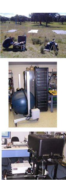
ICTS-PAI support units
Trajectography and data processing: It provides the capability to track aircraft in flight with a Ground Control Station and three optronic tracking units. It also includes workstations and associated software for real time flight-testing data and required tools for data processing. These facilities are already been used with either aircraft or UAS's.
Telemetry Mobile and Fixed Ground Control Stations: A full Instrumented Telemetry Laboratory is available, what makes ICTS able to send and receive data obtained in real time either on-board or remotely. The laboratory has also a complete set of instrumentation to calibrate the probes mentioned before in the airborne segment.