


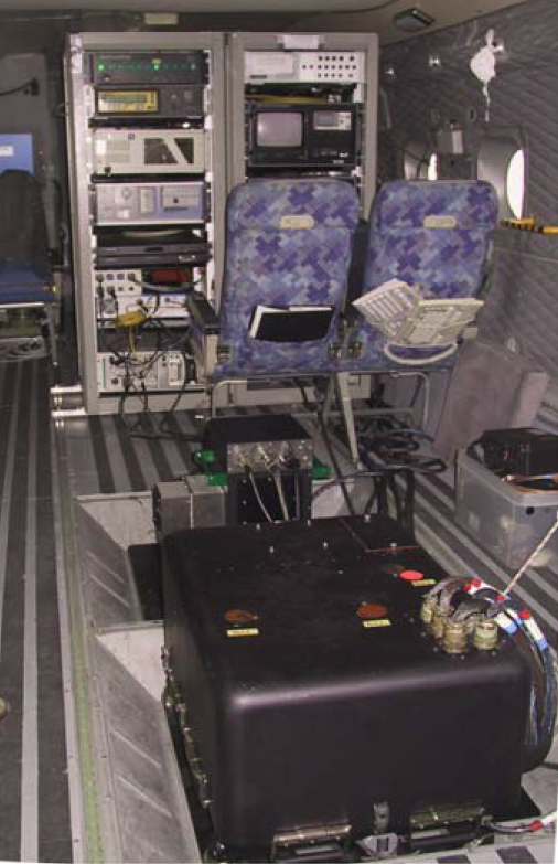
Airborne remote sensing instrumentation
AHS (Airborne Hyperspectral Scanner)
It is a hyperspectral whisk-broom type line scanner. It has been designed to provide an operational approach to the needs of the remote sensing community of users identified during years of participation in Earth observation projects. It provides high spectral, radiometric and spatial detailed datasets, suitable to be applied to a wide range of researching fields. It became operational in 2003, and is updated and upgraded periodically in order to keep it within specifications and as an applicable instrument to respond to the new requirements of the users.
MAIN TECHNICAL CHARACTERISTICS:
- Technology: hyperspectral whisk-broom line scanner
- Spectral range: 80 spectral bands VNIR(20)+SWIR(42+1)+MIR(7)+LWIR(10)
- FOV: 90° / 1.571 rad
- IFOV: 2.5 mrad
- GFOV: 2 ÷ 6 m at 70 ms-1 (140 KTS) platform ground speed
- Scanning frequency: 6.25, 12.5, 18.75, 25, 31.25, 35 Hz
- Digitization accuracy: in 12 bits
- Pixels per scan line: 750
- References: Two internal black bodies with selectable temperature
- Geolocation: based in an INS/GPS device
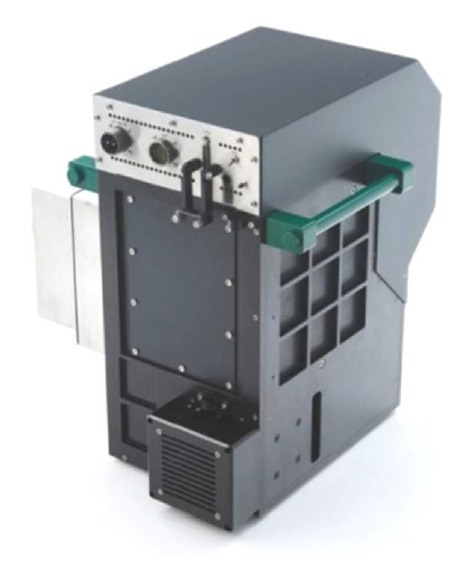
CASI 1500i (Compact Airborne Spectrographic Imager)
It is a push-broom type airborne hyperspectral imager purchased in November 2008. It offers 1500 pixels per line encoded in 14 bits. Its Field Of View (FOV) is 40°. It provides up to 288 spectral channels in the VNIR region with a spectral range of 380-1050 nm. Its Instantaneous Field Of View (IFOV) is 0.49 mrad, which make possible to get a sub-metric spatial resolution. An IMU device has been installed in the detector head to collect the attitude and position data required to obtain directly geo-locate output datasets.
MAIN TECHNICAL CHARACTERISTICS:
- Technology: hyperspectral push-broom imager
- Spectral range: 380 - 1050 nm (selectable)
- Spectral configuration: up to 288 spectral channels (FWHM: 3.2 nm)
- FOV: 40° / 0.698 rad
- IFOV: 0.49 mrad
- Spatial resolution: Sub-metric
- Digitization accuracy: 14 bits
- Pixels per line: 1500
- Geolocation: based in an INS/GPS device
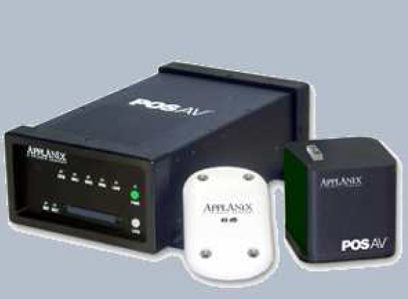
Navigation and positioning module
It is based in a dual-frequency GPS receiver and an IMU device installed in the optical frame inside of the scan head module. Attitude and position data are collected and recorded during the flight. The use of suitable time markers allows an accurate synchronization with the remote sensed images line per line, and results in accurate directly geo-located output datasets.